대충 요약하자면, 콧제부에 대한 간략한 소개(인구 4,000명 이하)와 비행기에서 내려보니 자기 짐이 도착하지 않았다는 이야기,
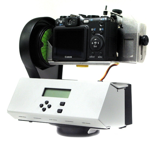
중간 아래쯤에 기가팬(Gigapan) 파노라마 사진을 찍었다는 이야기가 있는데, 아래가 Gigapan robotic camera mount입니다. 가운데 윗부분에는 디지털카메라가 달려 있는데, 이 카메라 마운트가 자동으로 돌아가면서 360도 파노라마 사진을 촬영해 줍니다. (저도 꼭 하나 갖고 싶은 장비라는...ㅠㅠ)
참고로 Gigapan 사이트에서 Seoul로 검색해보면 현재 37개의 사진이 등록되어 있으며, 이중 일부는 구글어스(Google Earth)의 갤러리(Gallery) 폴더속에 있는 Gigapan Photos 레이어를 켜시면 보실 수 있습니다. 아래는 강남 파이넌스 센터를 촬영한 기가팬 사진을 띄워본 것입니다.
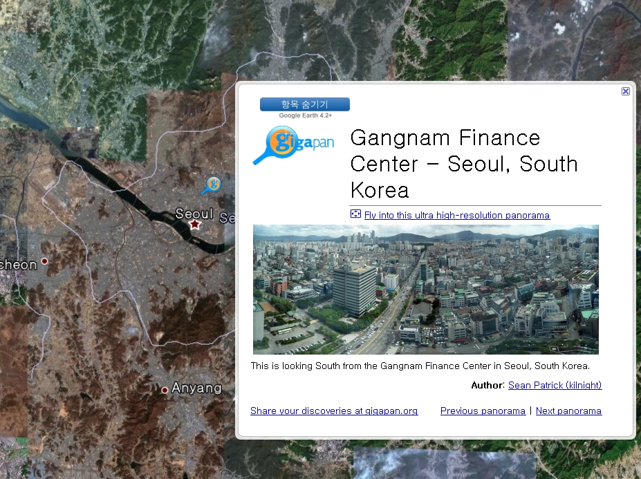
아래는 이 사진을 직접 삽입시켜 본 모습입니다. Gigapan 사진을 삽입하는 방법은 여기를 읽어보시면 되는데... 약간 귀찮네요. 확대를 해 보세요. 길안내 표지판까지 구분할 수 있습니다~~
민, 푸른하늘
http://google-latlong.blogspot.com/2008/09/geo-educations-alaska-trip-diary-day-4.html
Saturday, September 20, 2008 at 8:24 PM
Kotzebue: guns, drugs and helicopters
Now that’s an attention-getter! What kind of crazed situation did the Google Geo Education
group get itself involved in? I'll get there soon enough, but first let
me spend some time providing the back-story. Kotzebue consists of a
little fewer than 4,000 people and is on the up-and-up, having gotten
all of its roads paved within the past few years (the asphalt serves as
effective dust control compared to the previous gravel-based roads). My
entry into Kotzebue started stressfully enough, as our airline had left
my luggage in
As with our previous day in Barrow, our first moments at
After class, Dave took us in the yellow bus to the local field office for the State of Alaska Department of Fish and Game.
There we met wildlife biologist Jim Dau and learned about how his team
tracks caribou migration patterns. Jim's dataset spans more than twenty
years and consists of following radio-tagged caribou across the western
half
====
구글 LatLong 블로그 목록 : http://heomin61.tistory.com/6
2008/09/17 - [LatLong] - 구글어스 알래스카 교육과정 첫날
2008/09/21 - [LatLong] - 구글어스 알래스카 교육과정 둘째 날
2008/09/23 - [LatLong] - 구글어스 알래스카 교육과정 세째 날